Raster Chef
(originally presented on Nov. 11th, 2022 as a part of NCSU CGA’s lunch & learn series)
all code examples can be found at github.com/ocsmit/raster-chef
Goals & Concepts
Overview & goals
- Understand historical context of access
- Know where to search for data
- Gain familiarity and resources to ingest data
Concepts covered
- Raster data model
- Cloud Optimized GeoTIFF (COG)
- Spatio Temporal Asset Catalog (STAC)
- API access
Platforms & APIs
- NASA EarthData
- Planetary Computer
- Planet
Key concepts
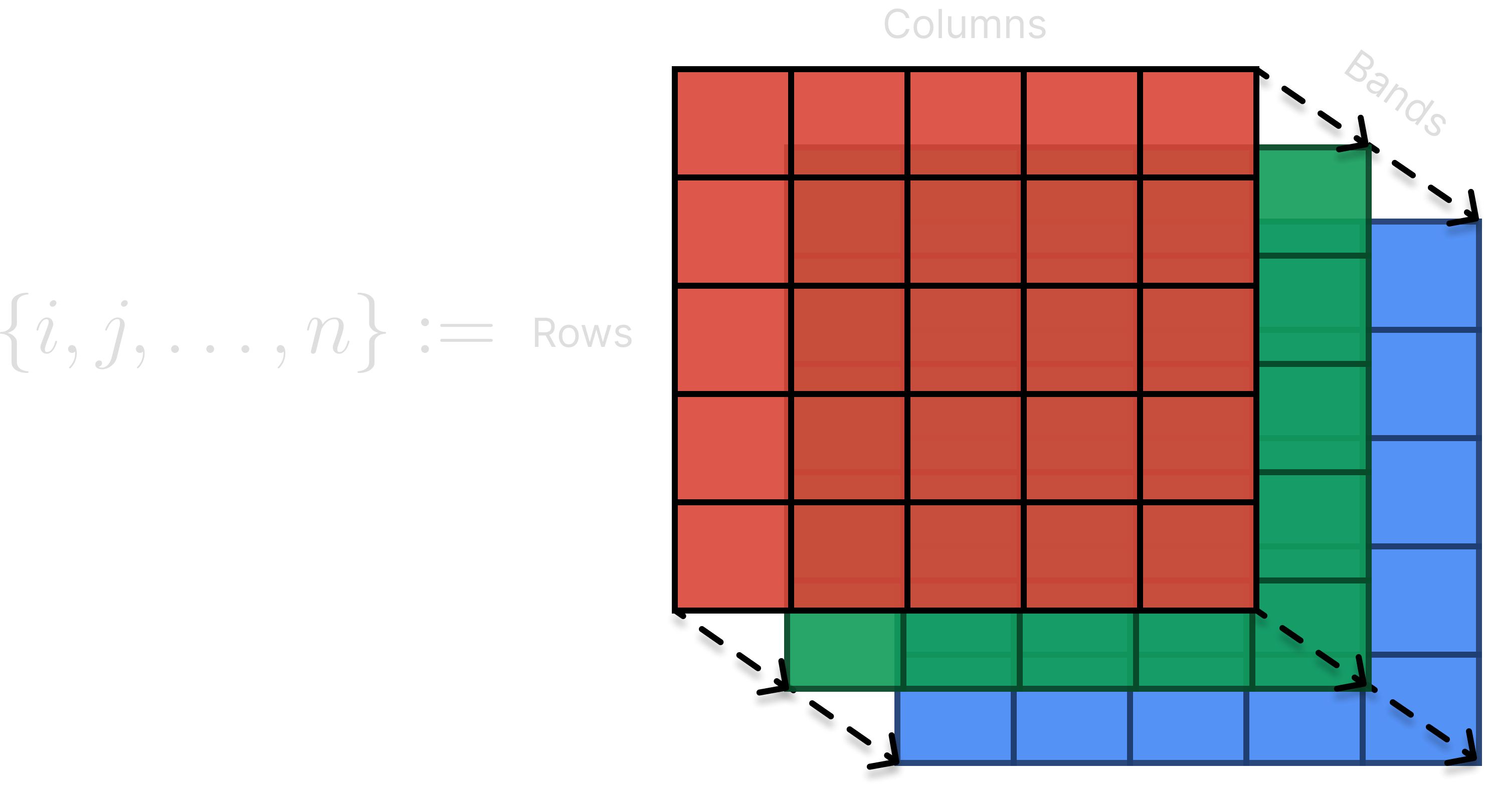
Raster data model
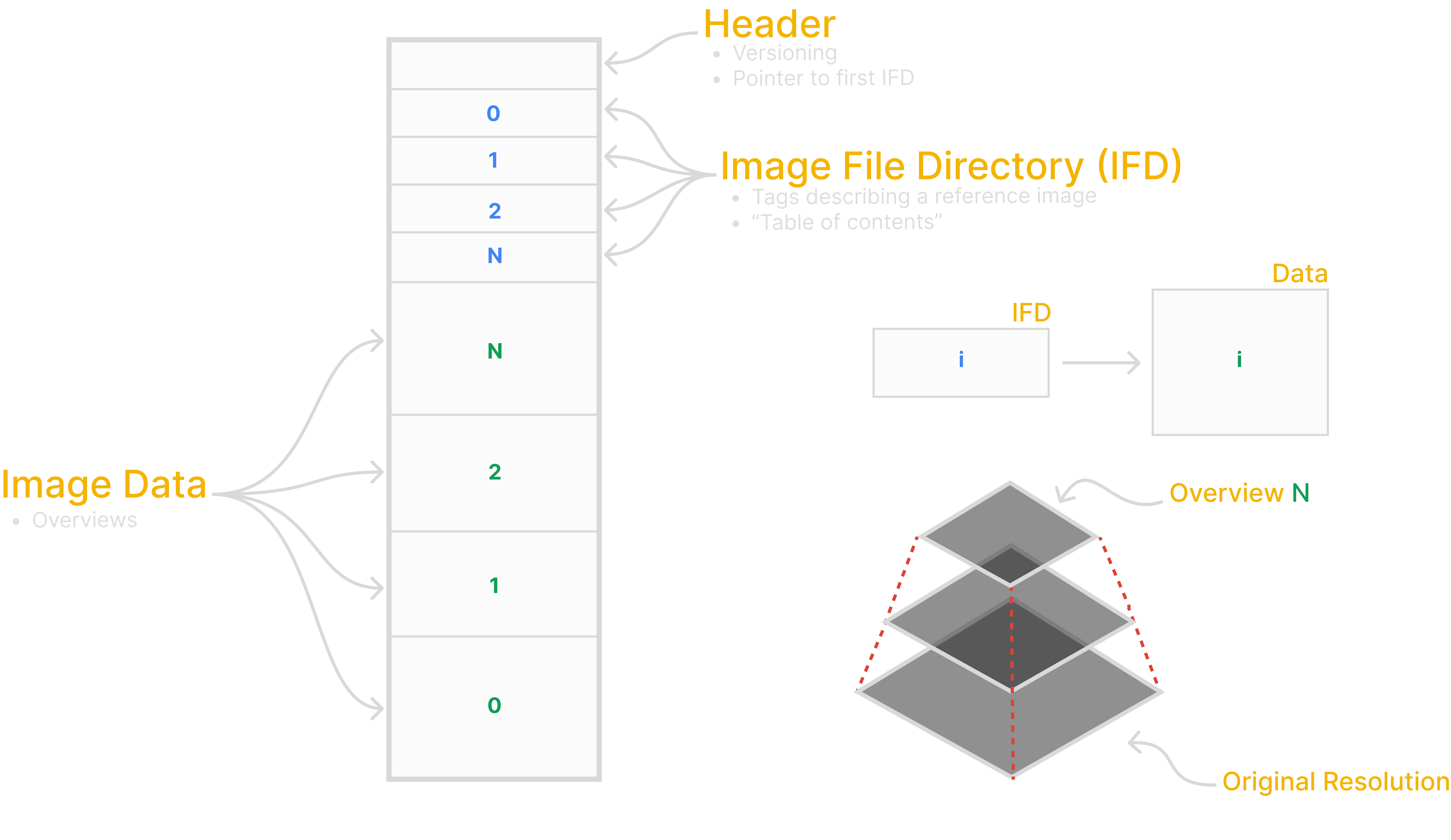
Cloud Optimized GeoTIFF
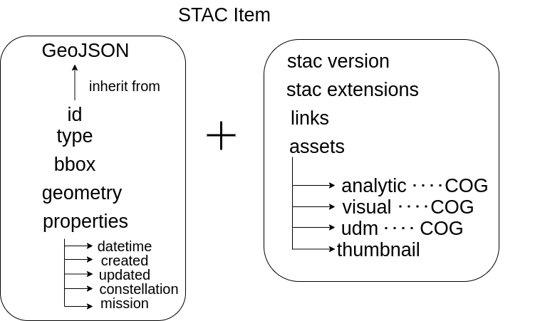
Spatio Temporal Asset Catalog
Extends the GeoJSON object and consists of catalogs, and collections, items
The spec additionally defines a RESTful API
STAC - Catalog
Top Level object which wraps other catalogs, collections, and items
{
    "stac_version": "1.0.0",
    "type": "Catalog",
    "id": "20201211_223832_CS2",
    "description": "A simple catalog example",
    "links": []
}
STAC - Collection
Defines a set of common fields to describe a group of Items that share properties and metadata.
{
    "stac_version": "1.0.0",
    "type": "Collection",
    "license": "ISC",
    "id": "20201211_223832_CS2",
    "description": "A simple collection example",
    "links": [],
    "extent": {},
    "summaries": {}
}
STAC - Item
Most important part of the spec, contains relevant metadata for a scene and links to the assets
{
    "stac_version": "1.0.0",
    "type": "Feature",
    "id": "20201211_223832_CS2",
    "bbox": [],
    "geometry": {},
    "properties": {},
    "collection": "simple-collection",
    "links": [],
    "assets": {}
}
STAC - API
Defined as REST interface which will generate a GeoJSON of items based on a user request.
Endpoint is `/stacname/search`. The user requests a date range and a bounding box, e.g.
{
  "bbox": [5.5, 46, 8, 47.4],
  "time": "2018-02-12T00:00:00Z/2018-03-18T12:31:12Z"
}
and receives all items in the catalog which intersect the bounding box and time range.
STAC - API
Evolving landscape, but primarily accessed with `pystac-client`

Key libraries
- GDAL
- Rasterio
- NumPy
- PyPROJ
Platforms 🛰️
NASA EarthData
EarthData
NASA’s premier data repository. A part of Earth Observing System Data and Information System (EOSDIS).
Contains 59 PB of data. Expected to grow to 250+ PB by 2025.
EarthData
Built around Common Metadata Repository (CMR), a high performance metadata cataloging system.
Exposes `CMR-STAC` which provides access to entire catalog with STAC compliant API. Has 54 seperate clients containing different data.
Accessing EarthData API for HLS
Harmonized Landsat Sentinel is accesed via the `LPCLOUD` client.
STAC_URL = "https://cmr.earthdata.nasa.gov/stac"
catalog = Client.open(f'{STAC_URL}/LPCLOUD/')
and is split between two collections for the gridded Sentinel 2 and Landsat 8
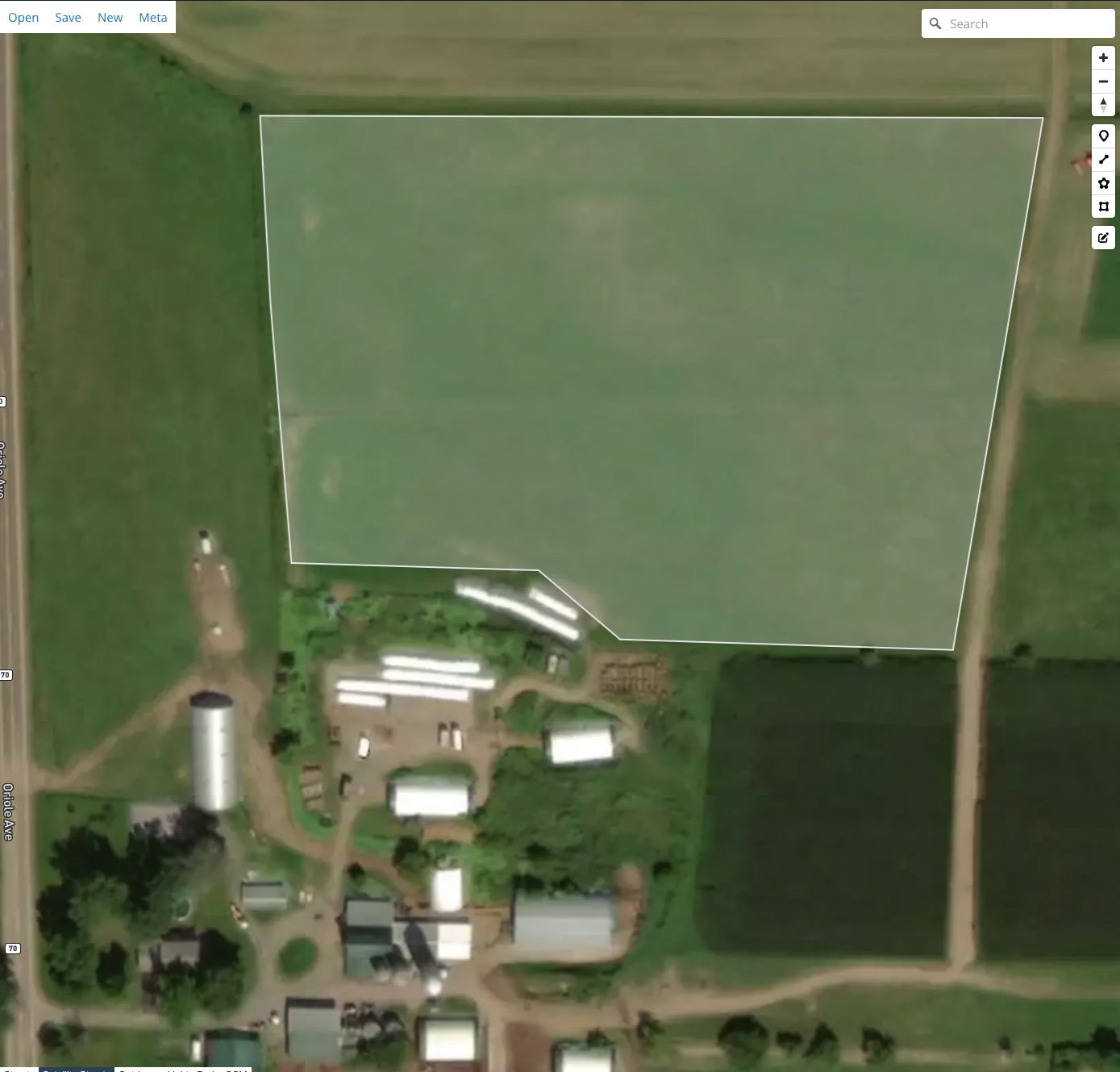
Parse geojson
with open(GEOJSON_PATH, "r") as fp:
    geojson = json.load(fp)
bbox = geojson["features"][0]["geometry"]
create search query
search = catalog.search(
    collections = ['HLSL30.v2.0', 'HLSS30.v2.0'],
    intersects = bbox,
    datetime = "2022-06/2022-06",
    limit = 100
)
The search query returns a STAC json that contains links to each band’s COG in the cloud, e.g.
...
{
  "B05": {
    "href": "https://data.lpdaac.earthdatacloud.nasa.gov/...
             /HLS.S30.T17TMF.2022154T161829.v2.0.B05.tif"
  }
},
...
COG memory layout allows us to request only our extent
bbox = bounds(geometry)
coord_transformer = Transformer.from_crs("epsg:4326", geo_fp.crs)
# calculate pixels to be streamed in cog
coord_upper_left = coord_transformer.transform(bbox[3], bbox[0])
coord_lower_right = coord_transformer.transform(bbox[1], bbox[2])
pixel_upper_left = geo_fp.index(coord_upper_left[0], coord_upper_left[1])
pixel_lower_right = geo_fp.index(coord_lower_right[0], coord_lower_right[1])
# make http range request only for bytes in window
window = rasterio.windows.Window.from_slices(
    (pixel_upper_left[0], pixel_lower_right[0]),
    (pixel_upper_left[1], pixel_lower_right[1]),
)
subset = geo_fp.read(1, window = window)
Utilizing multiple cores to download data (found here)
def downloader(item, geometry, outpath):
    ... # subset and write to disk

if __name__ == "__main__":

    ... # STAC query to get assets

    import multiprocessing as mp
    with mp.Pool(5) as pool:
        pool.starmap(
            downloader, [(item, geojson, outpath) for item in items]
        )
While we are downloading to disk, with COG’s we can keep the data in memory instead
subset = geo_fp.read(1, window = window) # This is just a NumPy array
and perform our calculations without writing to disk
Planetary Computer
Built around STAC API and uses open standards and software.
Contains 24 PB of data, growing rapidly. Full analysis ready Sentinel 2 catalog.
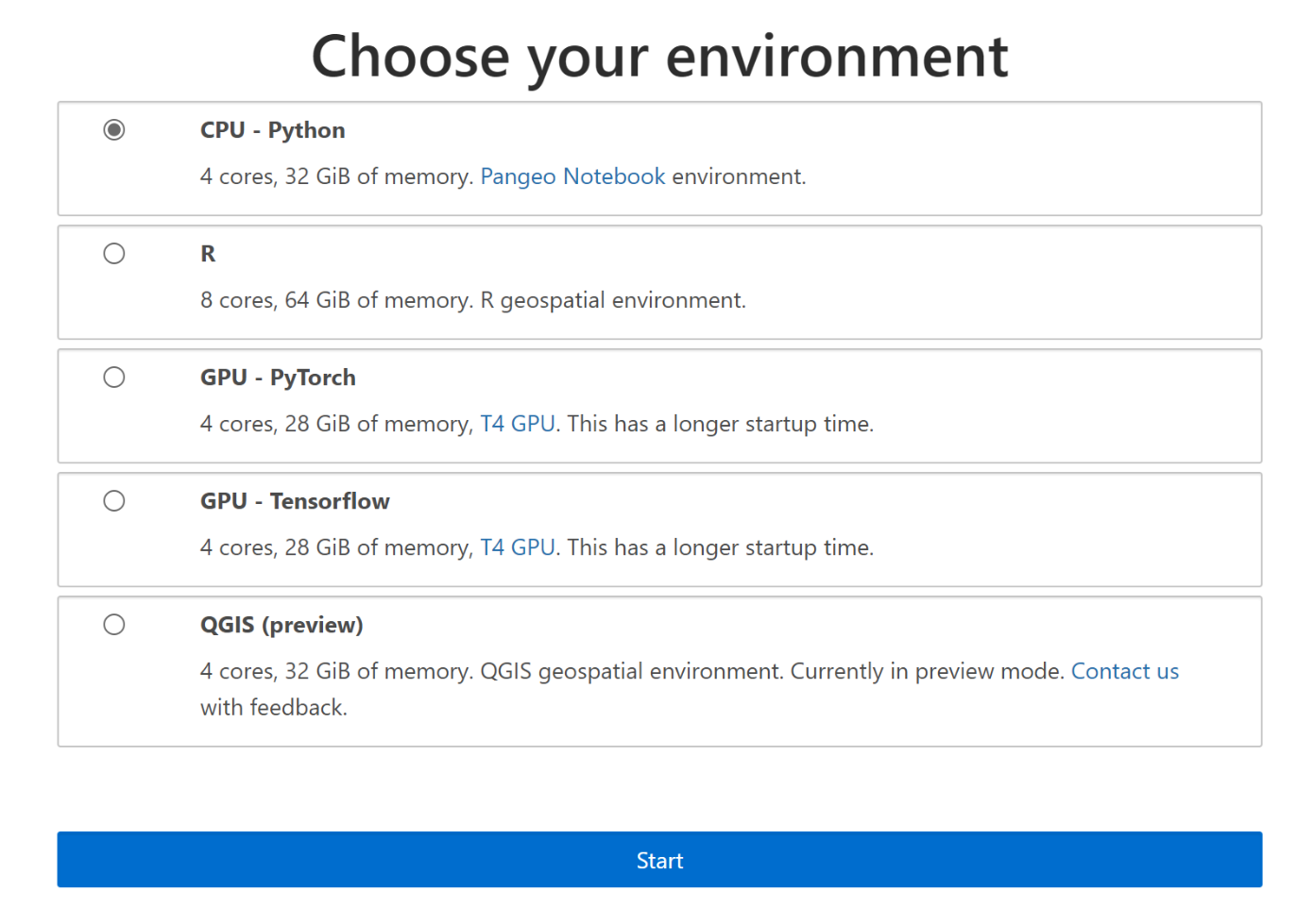
Offers “Hubs” for cloud computing
Querying data is the almost the same as with EarthData
catalog = pystac_client.Client.open(
    "https://planetarycomputer.microsoft.com/api/stac/v1",
    modifier=planetary_computer.sign_inplace,
)


time_range = "2009-01/2020-01"

search = catalog.search(
                        collections=["landsat-c2-l2"],
                        bbox=bbox,
                        datetime=time_range,
                       )
items = search.get_all_items()
stackstac
“Easier cloud native geoprocessing” - Generates a 4D datacube from a collection of STAC items
import stackstac
stack = stackstac.stack(items, bounds_latlon=bbox) * Can clip on load
>>> xarray.DataArray'stackstac-1b418a2d8beee2539c17d7af4d7720cb'
    time: 8
    band: 22
    y: 7972
    x: 12372
>>> dask.array chunksize=(1, 1, 1024, 1024), meta=np.ndarray
>>> Coordinates: (31)
>>> Attributes: (4)
Masking
mask_bitfields = [1, 2, 3, 4]  * dilated cloud, cirrus, cloud, cloud shadow
bitmask = 0
for field in mask_bitfields:
    bitmask |= 1 << field * Fun bit manipulation \>>

bin(bitmask)

qa = stack.sel(band="qa_pixel").astype("uint16")
bad = qa & bitmask  * just look at those 4 bits

good = stack.where(bad == 0)  * mask pixels where any one of those bits are set
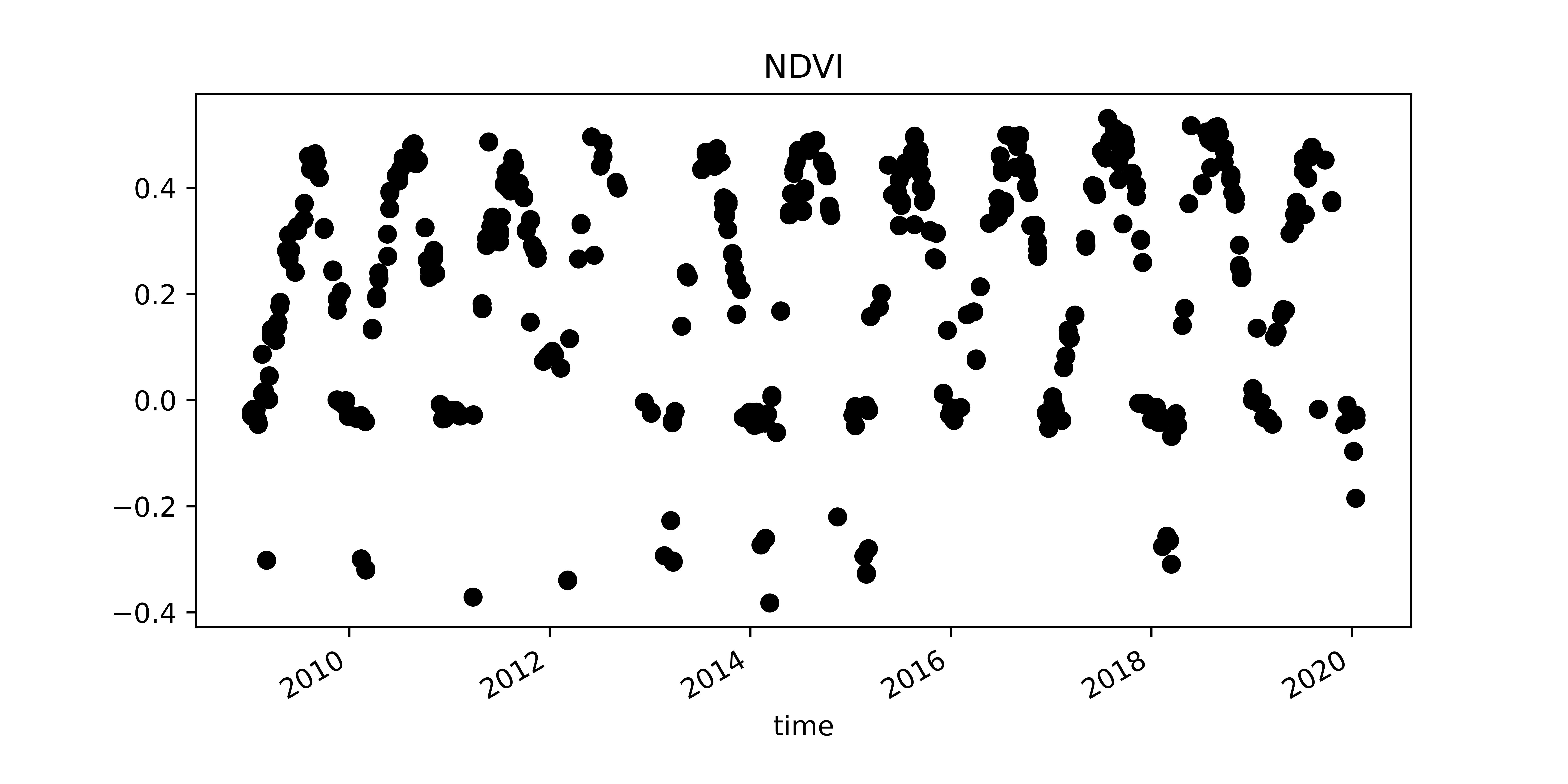
NDVI TimeSeries
\[ NDVI = \frac{(nir - red)}{(nir + red)} \]
nir, red = stack.sel(band="nir08"), stack.sel(band="red")
ndvi = (nir - red) / (nir + red)
ndvi = ndvi.persist() * Dask compute
NDVI TimeSeries
xcen = -423850
ycen = 5100220
# select nearest point and plot timeserie
s = ndvi.sel(x=xcen, y=ycen, method="nearest").to_series()
s.plot(title='mean NDVI', figsize=(8,4), style='ko')
Planet API
Only way to bulk order Planet data.
Access to PlanetScope, SkySat, Rapid Eye, Sentinel 2, and LandSat
Orders API
Orders V2 api allows user to offload a lot of compute to Planet.
Provides band math, clipping, compositing, coregistering, harmonization, reprojecting, tiling
Orders API
Tools can be chained together
{"name": "toar and reproject",
  "source_type": "scenes",
    "products": [{
      "item_ids": [
        "20170614_113217_3163208_RapidEye-5"
      ],
      "item_type": "REOrthoTile",
      "product_bundle": "analytic"
    }],
  "tools": [{
      "toar": {
        "scale_factor": 10000
      }},
    {
      "reproject": {
        "projection": "WGS84",
        "kernel": "cubic"
}}}
Orders API
Need to write own JSON queries or use third party library
POrder is a 3rd party library to interact with their API

Questions?